Southern Pacific Lines
Coast Line Division
“The Route of the Octopus”
Southern Pacific Lines
Coast Line Division
“The Route of the Octopus”
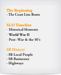
The Beginning
The Coast Line Route
The area in between the coastal lands of Santa Barbara and San Luis Obispo Counties was called the “gap”. SLO - S.B. is the “stormy end”.
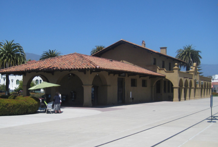
Santa Barbara in my day!
Bruce Morden sent along a link to some videos by a fellow named Daryl who had transferred some VHS and uploaded it to Youtube. Taken in the 80s! http://www.youtube.com/watch?v=HtOIeRt7-m4
S.P. Train Order Signal
There was a train order signal in Santa Barbara that was just colored lights without a semaphore type blade. See article in the August 1985 issue of Pacific RailNews, "No More Train Orders at Santa Barbara." Specifically, a photo of the colored light train order
signal at Santa Barbara can be found on page 21 (the full article on pages 18-21).
In the ' 60s and earlier, there was no train order signal of any kind in front of the Santa Barbara depot. Colored light train order signal was put up after Santa Barbara ceased being a crew-change point.
Such signals were found elsewhere on the SP system. There was a train order board with lights at Surf in the 70s, when the station was reduced to just the north end of the structure. Pictures of it lit with the aspect in the letters "TO" when a train order was to be picked up.The signals in the preceeding blocks on either side of the Surf block had letter "M", and "S" approach signals below the target to designate whether a train was to enter the siding, or use the main. Other letter type signals at Redding as well.
Charlie Burns
SLO TimeLine
Historical Moments
1894 - The first train reached Santa Barbara
1928 - F.D.R. toured the Coast Line (*see Bulletin 8/1928, pg. 8-9)
1940 - In Oct., , two 14” rail mounted coastal defense guns fired out to sea at the Naples spur
1941 - NBC Sammy Kaye Serenade
Navy beans sold from 2 cents to 33 cents
“Montebello” - Union Oil Tanker torpedoed (December 23) by Japanese sub off coast near Cambria
1942 - A Japanese submarine fired shots at Ellwood Oil Field on Feb. 23, 1942
Blackout drill - 3 short and 1 long blast, and the street lights would dim
1943 - Due to wartime priorities, all train travel must be booked five days in advance
1946 - First Pismo Beach Clam Festival
1948 -
1950 -
1957 - Soviet Premier Nikita Khrushchev rode the Coast Line
1958 - Trains south from S.F. carried up to $5 million of military payroll
Santa Barbara History
SB Local Sites
The Morton Bay Fig Tree "park" was located between the southwest corner itself and the tracks near the depot. The fig tree as it was planted in 1878 and branches where 151 ft. long.
Rusty Ron Plies
SB Local People
Santa Barbara Businesses (1930)
BusinessesLocation Sanborn Map #
SB StationSide tracks#110
Bekins Warehouse No. 2Spur#111
Fish MarketButts up to Bekins#111
Williard - Cockroft Wholesale GrocersSpur same as above#111
Restaurant Equip. StorageButts up to W-C#111
Concrete loading platformsSpur ends up against it#144
Hay storageSpur#144
S.P. Milling Company (Bldg Materials)Spur same as above#144
Rags & Paper Storageside tracks#144
S.P. Freight Houseside tracks#145
Weber Baking Company#145
Southern Counties Gas Co.Side tracks & Spur#153
Union OIlSide tracks same as above#153
PennzoilSpur#153
Signal OilSpur same as above#153
Hwy 101 crosses over tracks#154
Cement Warehouse & tankSpur#160
Western Motor Transfer Inc.Spur #161
Puritan Ice Co. (other side of tracks)Side tracks#155?
Ambrose Mill and Lumber
On Sanborn maps on the 1950 map for the corner of State Street and US 101, (Montecito Street) there are shown service stations on both the southwest and southeast corners, and "auto sales & service" businesses on the northwest and northeast corners.
West of the depot, behind the Railway Express Agency building, there was a wholesale liquor warehouse at the southeast corner of Chapala and Montecito/101. No company names are shown for anything other than SP and Railway Express.
Paul Jackson
There was a Standard gas station on the southwest corner of State & Hwy 101 in the 1950's.
Jon C.
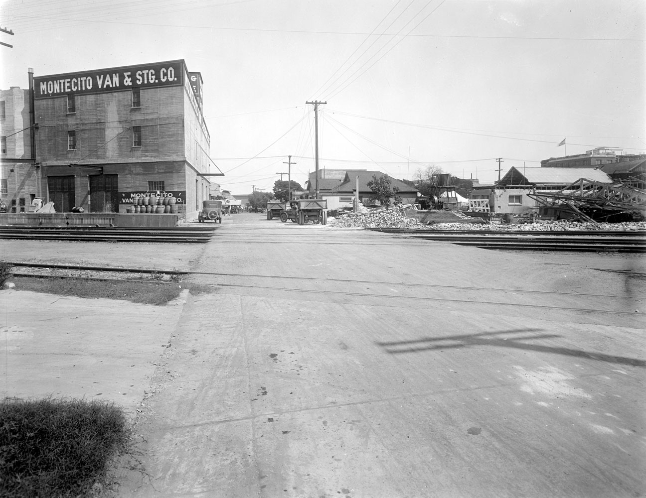
Bekins Warehouse #1
The Bekins building is a three story trapezoid with the non-parallel sides along the tracks (125 feet) and along Mason St (100 feet). The parallel sides are along Helena (140 feet) and Anacapa (100 feet). The Bekins Warehouse had a spur.
Bruce Morden
Here are a few shots of the Bekins Building after the 1925 earthquake.
http://piru.alexandria.ucsb.edu/collections/sylvester/sbquake//sbq0466.jpg
http://piru.alexandria.ucsb.edu/collections/sylvester/sbquake//sbq0484.jpg
Modeling the Bekins Warehouse
That would scale out to 14 to 19 inches deep.
Bekins Warehouse #2
The other Bekins building which is only one story and has arched doors. It is located two blocks east of the Depot on the mountain side of the tracks and did at one time have rail service.
Bruce Morden
Walthers (Kitbash)
Here is a building that can be used for kitbashing the Bekins Warehouse.
http://www.walthers.com/exec/productinfo/700-88
Puritan Ice Company
The following website shows historical photos of the company and its relationship with the SP. Great shots for modeling purposes. and for those citrus modelers too.
http://www.decomposingsb.com/?cat=18
Gasoline Stations
There were several gas stations and they were all on the south side of 101 (toward the ocean). One was on the corner of Montecito (which was the south frontage road) and Chapala. The big Moreton Bay Fig tree actually spread its arms over the top of part of the station. The Standard station was on the SE corner of State and Montecito. See Sanborn's Maps for reference.
Bruce Morden
Highways
Old Highway 101
To Los Angeles (south) & San Luis Obispo (north). Santa Barbara city was just about the final portion of 101 to be grade separated, with the crossings at Quarantina, Salsipuedes, Garden, and State not being completed until 1990, when it was also widened through there form four lanes to six. Most of the rest was done by 1963, but the City, CalTrans, and business interest haggled over in-town intersections for over 30 years. Folks badly, remembered the stop-and-stop traffic through there especially on Sunday afternoons. The traffic at those stop lights backed up for miles on the three day weekends.
There was a signal at the intersection well into the 1980's.
Rusty Ron Plies
In those days, most all of the streets crossed the 101 up there, Carrillo being a good example, some with no more than stop signs. So you had to cross the highway, a four lane road, and the tracks, all in one swoop.
Jon C.
Here is 101 and State in 1955.
http://www.edhat.com/site/tidbit.cfm?nid=103413&showcomments=T
In 1990 all this was buried under the current freeway.
References
You can certainly go by the SB Library, but I would also direct you to the Gledhill Library at the Santa Barbara Historical Society.
Southern Pacific Santa Barbara Subdivision http://spsbsub.blogspot.com
Bruce Morden
Carpinteria, CA


